
Topographical Surveys
A topographical survey provides a detailed, accurate picture of your land - its levels, boundaries, features, and the way everything sits within the landscape. It captures both natural and man‑made elements, from contours and gradients to trees, buildings, utilities, and access points, giving you a clear understanding of how the land truly lies.
This information is essential for anyone planning construction, landscaping, or wider development work. By showing how the ground slopes and highlighting key high and low points, a topographical survey gives architects, engineers, and builders the insight they need to design confidently and responsibly. For projects involving existing structures, our Measured Building Surveys offer the same level of clarity indoors, helping you bring the full picture together.
A good survey can also reveal constraints or opportunities early in the process - natural features worth preserving, areas suitable for foundations, or obstacles that may require additional engineering solutions. And when boundary‑related documentation is needed, our Land Registry Plans provide clear, compliant drawings to support the legal side of your project.
Ultimately, a topographical survey forms the foundation for informed decision‑making. It provides the reliable, precise data needed to plan effectively, avoid surprises, and ensure that any development works in harmony with the land itself.
-
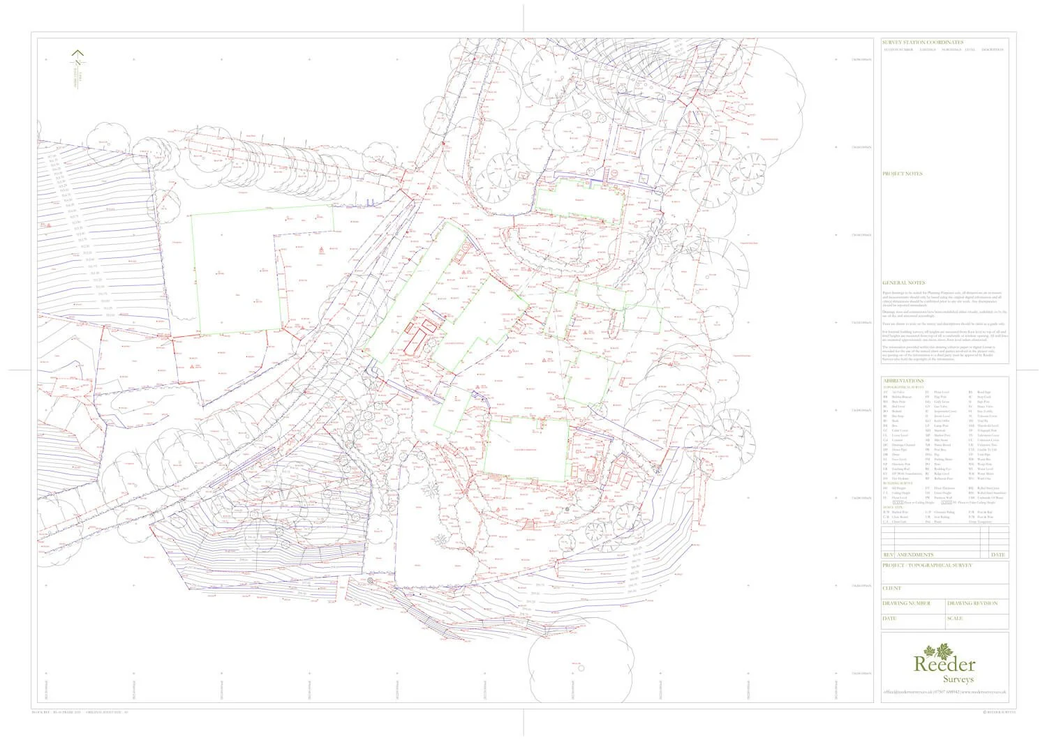
Example Topographical Survey with Contours
-
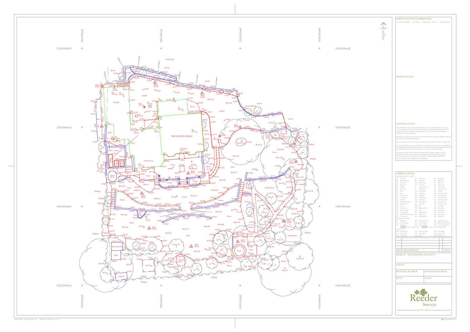
Example Topographical Survey without Contours
FAQ’S
-
A topographical survey gives architects, designers, and planners the accurate site information they need to shape any new development - from small extensions to larger projects. It forms part of many planning applications and helps ensure that proposed designs work with the land rather than against it.
-
Costs vary depending on the size and complexity of the area to be surveyed. Once we’ve seen a marked‑up plan and understand your project brief, we’ll assess the scope and provide a clear quotation.
-
This depends on the size and detail of the site. Some surveys take a few hours; others take longer. We’ll advise you of the likely timescale when quoting. After the site work is complete, we carefully check and prepare the data before issuing the final drawings, usually within ten working days.
-
Every survey is tailored to the site, but it typically records:
Ground levels and landform — spot levels, contours, slopes, and key high/low points.
Man‑made features — buildings, boundaries, walls, fences, paths, driveways, visible drainage, and above‑ground utilities.
Natural features — trees, hedges, vegetation, water features, ditches, and embankments
Survey control — permanent reference points for future use.
Relevant off‑site detail — nearby buildings or trees that influence the site.
This information is then presented clearly in your final drawings.
-
Final drawings are issued digitally in both AutoCAD and PDF formats, prepared at a scale appropriate to your project - typically 1:200 or 1:500.
-
It depends on the purpose of the submission and whether the plan needs to meet specific Land Registry standards. We can prepare fully compliant Land Registry plans when required - see our Land Registry Compliant Plan page for more information.
If you’re unsure what you need or where to start, feel free to get in touch - we’re always happy to guide you.